

The jet stream is back and brings with it an unsettled spell of weather for the UK and Ireland. 1 - All parts of the country will see rain or showers at some point this week. The highest accumulations will be over western Scotland, northwest and southern England, Wales and western
Month: September 2019
Video: Fast Forecast – Monday to Friday

Video: Sunday’s Look Ahead – MJO, ECMWF & CFS Weekly

Early Warning for Thursday
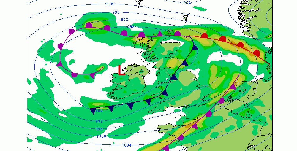
There's the potential for a bit of weather-related disruption across the British Isles on Thursday as a large area of low pressure reaches our shores. The current forecast from the GFS indications the potential for gale force winds, outbreaks of rain and very rough to high seas. Below is the current forecast
Video: Fast Forecast – Sunday to Thursday
Video: Saturday’s Look Ahead – Tropical Round-Up
Foehn (Effect) Friday
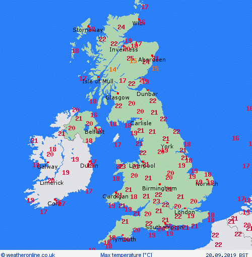
Temperatures across the UK on Friday were aided, in some places, by the Foehn Effect. This was most noticeable in parts of Scotland and Wales where daily maximum temperatures of 24C and 25C were recorded. Some of the warmest spots in Scotland were in the Highlands where Aviemore (25C), Altnaharra (24C)
