
Rainy weather is coming, but models disagree on the position of the strongest rain. One model, the GFS model, is currently forecasting a low pressure system and associated heavy rain slipping north across the west coast of Britain overnight from the 15th to the 16th of April. The meteogram for Cardiff is below:
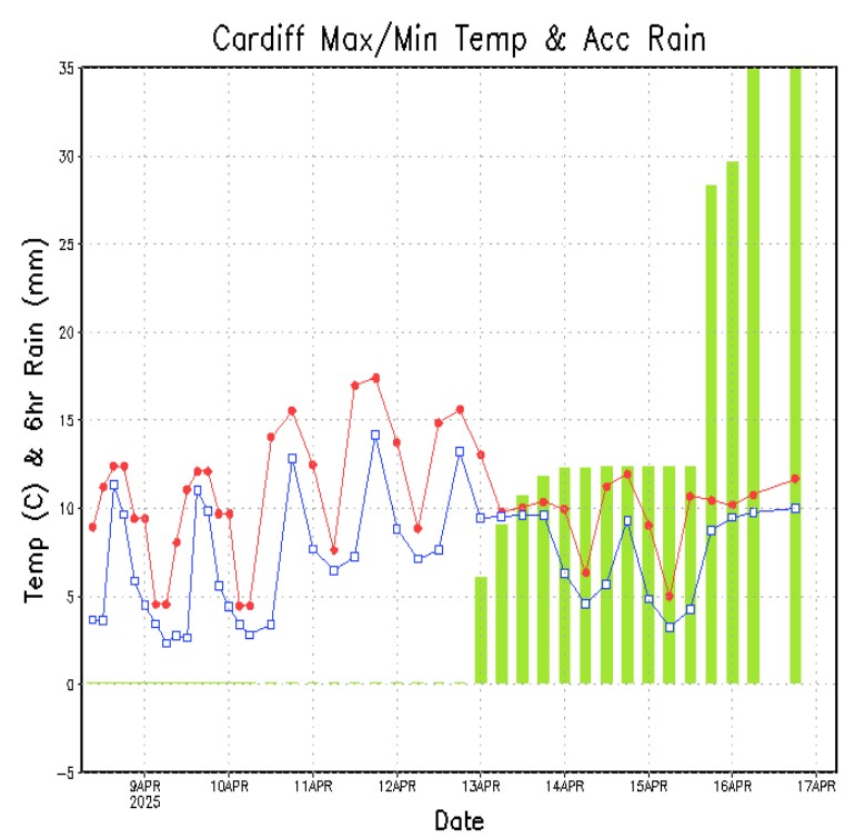
Up to 15mm of rainfall into Cardiff overnight into the 16th. A similar pattern is seen on the Glasgow meteogram, with the accumulated rainfall bars going off the charts. Further east in Britain and further west in Ireland, a similar rise in accumulated rainfall is seen but not with the same total depth.
I stress that this is a single model run from over a week out. ECMWF, another model often consulted, is pushing the low pressure further west and dropping less rain in total. Uncertain as of now - we'll keep a close eye on this system as it unfolds.
That's the weather story...for now!
-Dan
