
The analogue forecasts have just been updated. Treat what you see below very carefully, it can all change, but should give an indication what conditions we may have in the next 6-months or so.
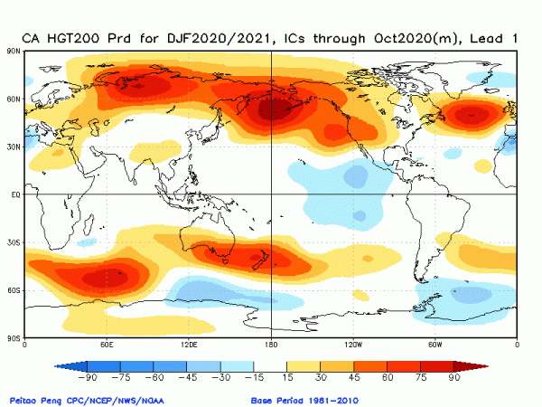
The chart below shows the average height anomalies at 200mb (approximately the level of the jet stream) through December, January and February. The red colours west of Ireland show high pressure here, extending eastwards through Ireland and the UK.
This would bring drier than average conditions and temperatures being close to average for the time of year. We do need to be careful with temperature in these circumstances as it can be still days bought about by high pressure can lead to colder weather than anticipated.
So it seems that winter is dominated by higher than average pressure, is likely to be drier (especially in the west), and temperatures close to normal. Note that there will be colder days.
Here's the 200mb forecast for spring, March, April & May.
It should the orange and red colours overhead. This brings high pressure. Conditions would again be dry. It would likely be warm too, although some cold nights.
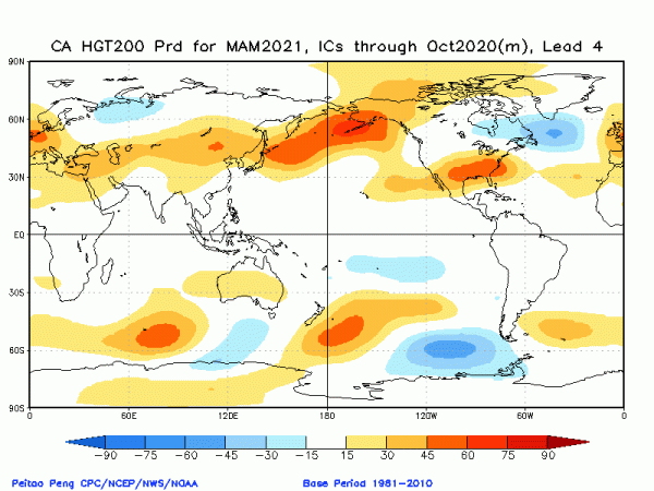
So according to the analogue forecasts it seems that high pressure is going to dominate the coming seasons. It will be interesting to see if this continues into the summer and beyond.
