
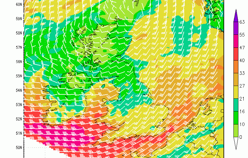
Storm Imogen has been named by Met Eirean. Forecast to hit Ireland and the UK on Monday, Imogen will bring gusts of wind of 70-80mph across Ireland and the south of the UK. I have to say this one is stretching things a little, the definition of 'widespread disruption' seems to struggle
Month: February 2016
Video: Fast Forecast – Sunday to Tuesday

12Z GFS sticks with Thursday snowy theme

Video: Saturday’s Look Ahead – Thursday Snow?

This is gonna get messy!

The jet that looks set to be over us for much of February, and possibly early March is going to be troublesome. Models really struggling, and my analogues give 50/50 split between mild and cool (notice not cold). So whilst the below 500mb anomaly (from TropicalTidbits.com) shows a strong jet and unsettled
ECMWF MJO seeing winter
The ECMWF MJO wheel shows passing through phases 5, 6 and 7 in the next month. Phase 5, entered around next Thursday (12th) is a chilly phase, with a jet south of Ireland and over southern UK. This backs the idea of lows crossing, and the risk of snow over northern
Snow cover on most UK mountains for many days ahead

Fronts encroach northwards into Scotland during Saturday daytime. Cold air in existence over the Highlands means precipitation will widely fall as snow for many hours, as it takes some time for the milder air to penetrate into the glens. Slowly, the freezing level will lift, from around 500 to 900m, allowing

