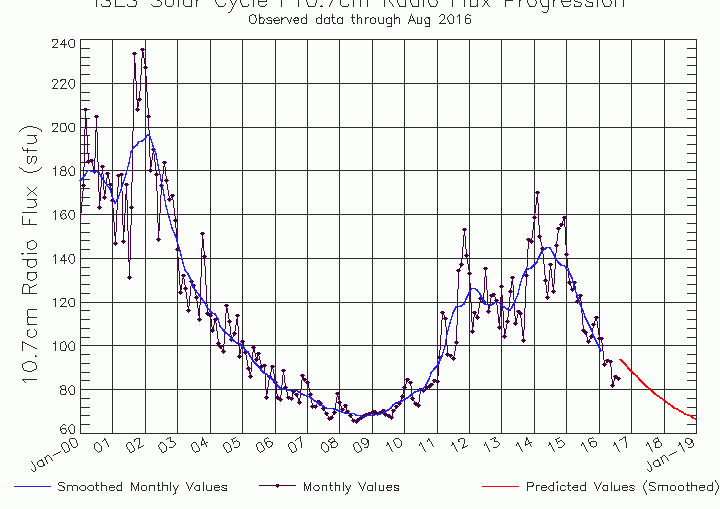
Latest data on solar activity suggests that the sun is heading towards a very quite spells i the coming months, The chart below shows the decline in activity since Cycle 24 peak in 1014 and the red line is the predicted activity in the coming months, If this is the path that
Month: September 2016
Video: Fast Forecast – Sunday to Thursday

Video: Saturdays Look Ahead – Models coming together?

That expanding Atlantic cold pool
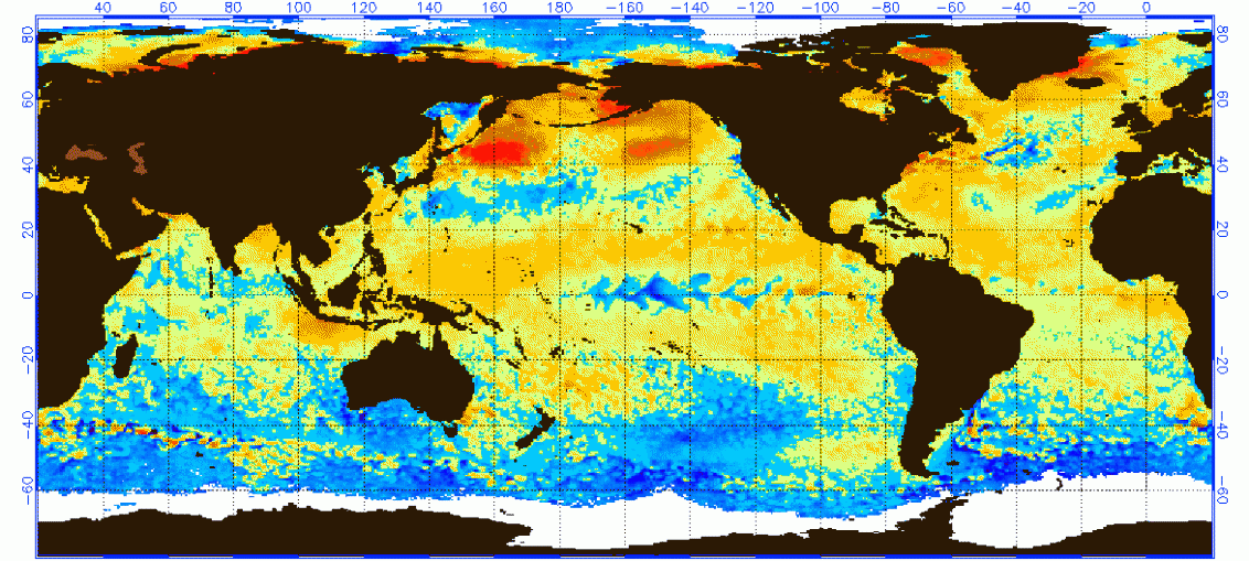
Sea surface anomalies are making for interesting viewing. Here they are at the start of the month ... And now ... look how the cold water in mid-Atlantic has expanded... Now, it's probably early days to start drawing too many impacts fro this, although it does tend to lean into high pressure building
Video: fast Forecast – Saturday to Wednesday
Video: Friday’s Look Ahead – Still watching those dates
Video: 2 Week Planner (16/9/16)

Torrential thunderstorms & flash floods latest
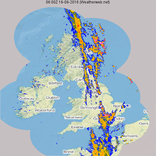
This morning has brought very high rainfall totals across parts of Oxfordshire, Berkshire and Bedfordshire. The radar below shows the radar at 7am this morning. Notice the red and white colours across the Home Counties, that's the cloud burst that brought about such severe flooding. Also look to the northeast, see the