
Phew, what a few days!
Many of you are asking what on earth happened to the dry weather for this week? Thankfully, everyone has been polite so far.
I really hate this part of my job; spotting a window that everyone needs and wants but then the weather models changing and a decent forecast goes out of the window.
So, you're owed an explanation as to what has gone wrong.
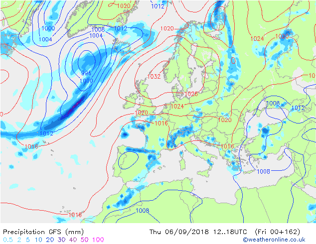
Well, here's the GFS forecast from last Friday (31st August) for today (Thursday 6th September). A stonking great high through the UK, an easterly wind, yes, rain in the south but dry for many.
A day later (the output from 1st September) shows this ... still high pressure dominating, rain now cleared from the south of the UK but notice the now northerly flow. Look at the low just north of Denmark. The GFS did get the idea of something being afoot and that low being somewhere east of the UK, but it still went for high pressure dominating and dry weather for most (although we predicted showers in the east at this stage).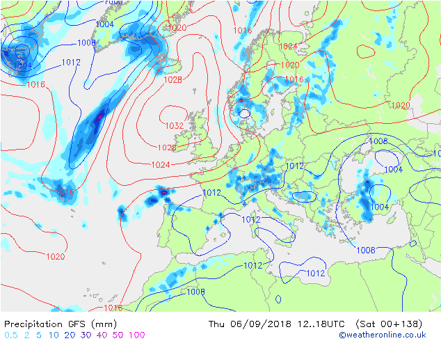
And then this happened...the forecast from Sunday 2nd September for today. Low pressure has grown to the east thanks to the northerly flow, high pressure to the west; pretty much how it will be.
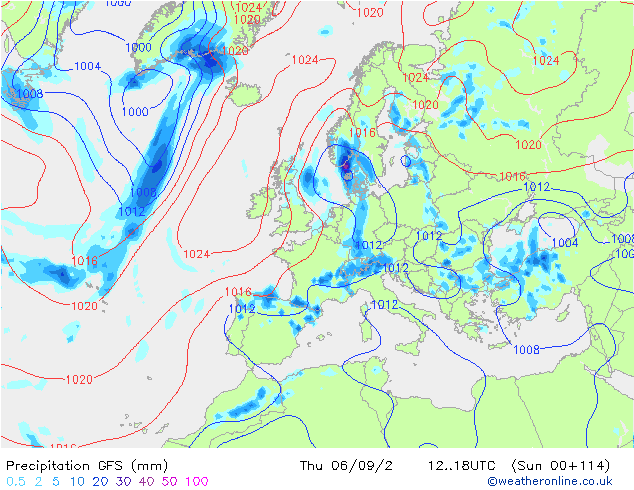
So what can we learn? Initially I don't think there's a lot there as all the models called high pressure. However, when we first spotted the signal for a northerly we need to be aware of showers t this time of year and that the northerly wind would feed cold air into the trough to the east and may deepen it.
What would we do differently given the same guidance"? Actually probably not a lot.
I think this comes down to one of those occasions where we throw our hands in the air and say, on this occasion the weather won!
