

As spring turns to meteorological summer on 1st June, this 6-week forecast from the ECMWF takes us into the middle of the month. Things are forecast to improve the first week of June after a mixed May. Here are the details ... 11th May to 17th May Low pressure over Scandinavia extending into the
Musings
5 Week Ahead Weather Things To Know
Heavy Rain Saturday Into Sunday
5 things for the weekend

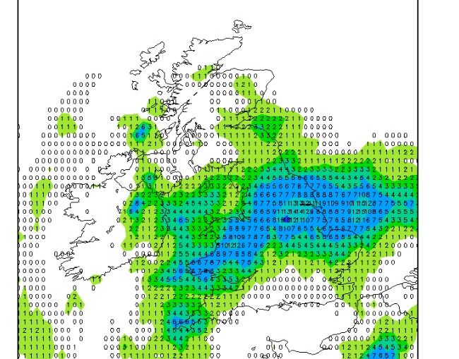
🌦️ Mixed weekend overall, with sunshine at times but also frequent showers spreading across many areas ⛈️ Some showers could turn heavy and thundery, especially across Wales, Ireland and southern parts of England 🌤️ Saturday should begin fairly bright for many before conditions turn more unsettled later 🌬️ Cooler air gradually pushes in
May 2026 – Final Guidance

+++ THIS FORECAST IS FOR PRIVATE CLIENTS ONLY AND MAY NOT BE DISTRIBUTED OR COPIED IN ANY WAY WITHOUT PRIOR PERMISSION. +++ MAY 2026 - FINAL WEATHER GUIDANCE ==================================== Issued: Thursday 30th April 2026 Contact: simon@weatherweb.net HEADLINES ========== + Slack low pressure early month + Variable weather regimes + Mild to warm, a few brief cool spells FACTORS AFFECTING MAY
NAO stays flat in the coming months

Make the most of the dry weather in early May because things are changing

The ECMWF 6-week next generation model is interesting in showing the middle and then second half of May as being wetter. The bars below show the anomalies of (from the top) 2m temperatures, surface temperature, precipitation and sea level pressure for each week to 8th June 2026. Notice how temperatures fall after
El Nino – Super?

Signs of a Pattern Change

Hello all! Through the remainder of April, the overall pattern looks relatively stable, with pressure holding fairly steady and suggesting largely settled conditions. However, as we move into the first week of May, the ensemble guidance begins to show a gradual downward trend in pressure, pointing toward a potential change in
