
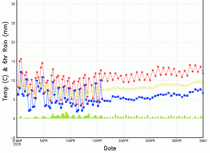
We're in a phase of proper spring-like weather. Frequent spells of wind and rain, punctuated by sudden warmer, sunnier periods. These weather systems are moving through rather rapidly, and will continue to do so in the near future. But what does the longer term look like? Here's the GFS Ensemble
Musings
April 2026 – Final Guidance

+++ THIS FORECAST IS FOR PRIVATE CLIENTS ONLY AND MAY NOT BE DISTRIBUTED OR COPIED IN ANY WAY WITHOUT PRIOR PERMISSION. +++ APRIL 2026 - FINAL WEATHER GUIDANCE ================================== Issued: Tuesday 31st March 2026 Contact: simon@weatherweb.net HEADLINES ========== + Mixed + Some drier spells + Tendency towards more changeable weather FACTORS AFFECTING APRIL 2026 FINAL GUIDANCE ============================================ + Higher pressure developing east
5 Week Ahead Weather Things To Know

Rain mostly in northwest

Good day everyone, Taking a look at the latest ECMWF rainfall anomaly charts for the next couple of weeks, a fairly clear pattern emerges. The bulk of the rainfall looks set to favour the northwestern parts of Scotland and Ireland, where Atlantic systems will continue to brush past and deliver frequent
5 things for the weekend

☀️ Bright spells developing across many areas at times during the weekend.🌦️ Showers remain possible, especially across northern and western regions.💨 Breezy conditions at times, particularly in exposed coastal areas.❄️ Some showers may briefly turn wintry over higher ground in the north.🌤️ Overall a mixed weekend with changeable skies but
An Unsettled Sunday Ahead?

ECMWF 6-Week Outlook to early May

The ECMWF 6-Week Outlook is now taking us well into meteorological spring; almost to the end of it in fact. Here's the latest from the model, taking us through April ... 30th March to 5th April High pressure southwest of Ireland. A cool northwest flow. Drier than average south and east, spells of sunshine. Most showers
Video: Tuesday’s Look Ahead – Outlook to early May

A Risk Of Wednesday Hail

5 things for the coming week

🌦️ A mixed start to the week, with a combination of brighter spells and occasional rain, especially across northern and western areas. 🌬️ Increasingly unsettled through midweek, as Atlantic systems bring breezier conditions and frequent showers. 🌨️ Colder air filtering in at times, allowing some showers to turn wintry over higher ground,