

A mix of springtime weather this week... 43200
Musings
Rising pressure? Yes or maybe?

Confused signals for May (and the summer)

5 things for the weekend

🌦️ A rather unsettled weekend with spells of rain at times, especially early on Saturday. 🌧️ Rain gradually clears eastwards through Saturday, leaving a mix of sunshine and showers. 🌤️ Brighter intervals developing later Saturday as conditions become more showery. 🌦️ Sunday starts largely dry and bright for many
Rainfall levels for next 2 weeks

Good day all, Looking ahead to the next couple of weeks, the overall weather pattern appears fairly settled. High pressure is expected to remain dominant across the European continent, occasionally extending into the eastern parts of the British Isles. At the same time, the Atlantic does not look vert active, with
ECMWF 6-Week Outlook into the second half of May

By the end of this forecast we are into the latest stages of spring. Temperatures should be rising as we head into northern hemispheric summer months and growth accelerates. Below is what the ECMWF 6-week model expects to happen ... 13th April to 19th April High pressure close to northern Sweden. An east to southeast
5 Week Ahead Weather Things to Know

Evidence builds for summer from weak NAO
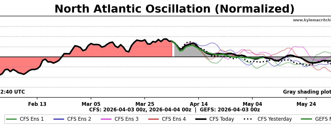
Here's an interesting one. The NAO form the CFS through to nearly July shows a trend towards the neutral/weakly negative. This indicates weaker westerly winds across the Atlantic Ocean. Now, given that the analogues hint at higher pressure north of the British isles in May, June and early July, this would be

