
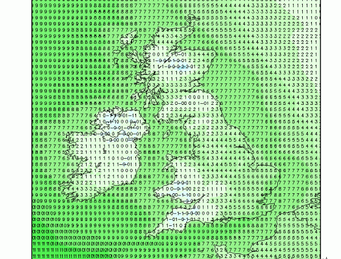
On Sunday, a front will pass east across the British Isles, brining rain to many areas. But looking at the temperature charts, something interesting caught my eye upon the passing of the front - see the minimum temperatures forecast for Monday at 6am, below: Cold low temperatures across Ireland, Wales, and
Musings
February 2026 – Final Guidance

+++ THIS FORECAST IS FOR PRIVATE CLIENTS ONLY AND MAY NOT BE DISTRIBUTED OR COPIED IN ANY WAY WITHOUT PRIOR PERMISSION. +++ FEBRUARY 2026 - FINAL GUIDANCE ============================== Issued: Friday 30th January 2026 Contact: simon@weatherweb.net HEADLINES ========== + Cool to cold for many + Unsettled, wettest south + Chance of snow events + Nearer average temperature sin far south FACTORS AFFECTING
5 things for the weekend

🌧️ Saturday stays mostly cloudy, with scattered showers moving north and a more persistent spell of rain arriving in the far southwest later. 🌬️ Breezy conditions at times, especially across western and southern regions. ☁️ Sunday starts damp in the northeast and southwest, but rain clears northwards through the
Drier colder north, wetter milder south

Good day! So, the synoptic pattern we’re currently sitting under looks set to stick around well into next week. In simple terms, we’ve got stubborn high pressure parked over Scandinavia, while a train of low-pressure systems keeps knocking on our door from the southwest. This setup drives mainly south-southeasterly winds across much
Storm Chandra From The Sky
NAO review and that cold is close

An interesting NAO, showing negative through much of the forecast period. Yes it is strongest negative to late February, but even after that it stays slightly negative. What does this mean? Well, a strong indication. that the usual Atlantic westerly winds are going to be weakened, possibly easterly. It again supports the
5 week ahead weather things to know

1947? Close but not quite, for now…

A wet week for most

5 things for the weekend

🌧️ Periods of rain and heavy showers, particularly across Ireland, Wales and southwest England, with local downpours at times 🌬️ Strong and gusty winds, especially along western and southern coasts, making it feel unsettled and blustery ☁️ Cloudy skies dominating much of the weekend, though eastern areas often stay