
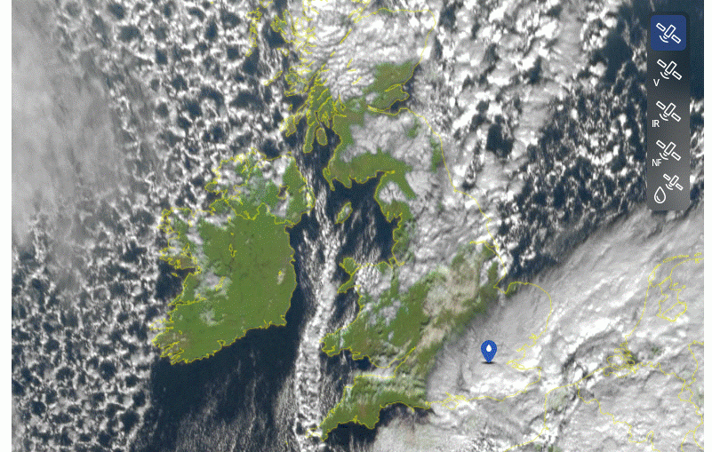
Every once in a while we get a weather regime that follows the rules and produces beautiful satellite imagery. We're having one now, check it out; this is the satellite image from 10:50am yesterday: Other than the frontal system in southeast England, the northerly winds are behaving exactly how they should
Musings
Troughs and Convergence Zones
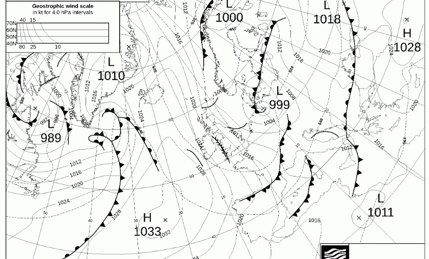
December 2025 – Preliminary Guidance

+++ THIS FORECAST IS FOR PRIVATE CLIENTS ONLY AND MAY NOT BE DISTRIBUTED OR COPIED IN ANY WAY WITHOUT PRIOR PERMISSION. +++ DECEMBER 2025 - PRELIMINARY GUIDANCE ===================================== Issued: Monday 17th November 2025 Contact: simon@weatherweb.net HEADLINES ========== + Frosty, fogg start, dry + Becoming more mixed + Risk sleet and snow FACTORS AFFECTING DECEMBER 2025 PRELIMINARY GUIDANCE ====================================================== + High pressure at
5 Week Ahead Weather Things To Know

Wintry spell incoming! Here's 5 additional details to help you navigate the weather this week: 1 - Mostly sunny Monday: Northerly winds draw the cold and drier air across the British Isles, and with high pressure over Ireland, sunshine is in the cards. Northern Scotland and northeast England will see more cloud
A Frozen Friday Morning

A cold but dry for most week, but rain possibly follows

5 things for the weekend

🌧️ Lingering rain early Saturday, gradually breaking up across England, Wales and Ireland. 💨 Cool easterly winds, giving a rather unsettled and chilly feel in central and southern areas. 🌤️ Brighter spells developing in Scotland, especially in the west, with a fresher, cleaner feel to the air. 🌫️ Crisper
Frosty Next Week
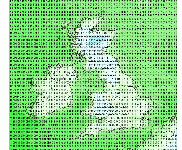
Rainfall on Friday

Several days of rain are ahead, but I'd like to show some forecasts for Friday. See below for three charts from the GFS ensemble showing three successive 6 hour rainfall totals from 6am until midnight on Saturday. Southeast Ireland, Wales, and the Midlands may see rainfall totals reaching into the 30s