You are here
Home > Musings (Page 51)

Here comes the breakdown

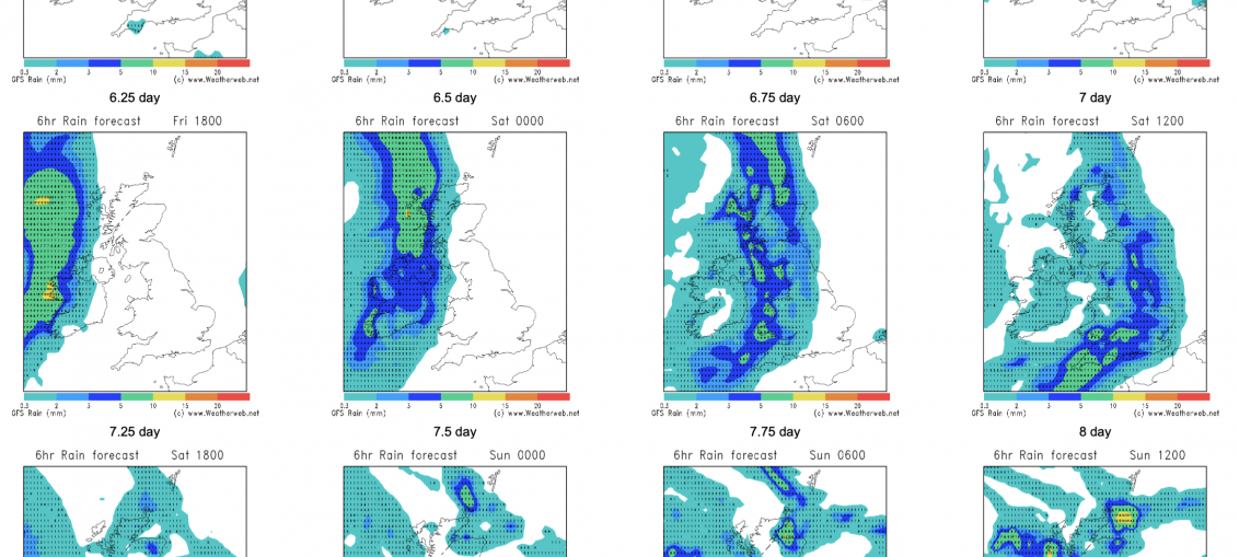
6 hour precipitation charts (available exclusively to you as a Weatherweb Premium member) showing the breakdown which is on the way. Some showers over the next couple of days, then drier again mid to late week. However by next weekend we see fronts moving in from the west, the jet stream strengthening

Rain on the horizon

Hello all, Well it has of the driest periods on the recent years, with no rain observed for most of the British Isles for quite a lot of days or weeks. However the models are keep bringing a new weather scenario from next Friday onwards, and that is for the westerly -

5 things for the weekend

☀️ Mostly Sunny Across the UK (Except East Coast) Expect plenty of sunshine for most areas, especially in the west and central parts. 🌥️ Cloudier Mornings in the East Eastern and southeastern counties will start both days cloudy, but skies will brighten by afternoon. 🌡️ Warm Inland, Cooler by the Coast Inland highs of 19–22°C,

You see it? Right there? That’s rain!

So here are the ensemble forecast from various models for the next two weeks. Look at the bottom chart. Then look to the far right. That's the rainfall forecast for two weeks time and right at the very end of the forecast that's rainfall, right there; not a lot, but rain in

ECMWF 6-Week Outlook to late June

As the dry weather continues it is to the 6-week run of the ECMWF model that we must look for signs of a breakdown. Here's what the latest ideas are...and it is good news for those who could do with some rain! 19th May to 25th May High pressure remains north. East to northeast

Five Weather Facts For the Coming Week

A settled week is ahead as high pressure establishes in the north; here's some details on how this will play out: 1 - Unsettled southwest on Monday - Several fronts around the southwest of Britain will facilitate showery bursts in south England and Wales, thundery bursts possible in Wales into night. 2 -

Rainfall anomalies maps

Good day all, Well below you can see the map of the Weekly Rainfall Anomalies for the European area (source: charts.ecmwf.int). As you can see during the next couple of weeks, we expect to be lower than normal due to persistence of the anticyclone. However, on the last map you can

5 things for the coming weekend

Good day all, As weekend is only a few hours away, please check the below facts about the weather: 🌤 Mostly dry and sunny weekend ahead!☁️ Some cloud at times in the northwest, especially later Saturday.🌧 A few showers possible on Sunday in the southwest and far north.🌡 Warm in the south

VE Day Weather Charts

As mentioned in yesterday’s look ahead video, here’s a closer look at the weather chart for 8th May 1945. A warm sector covered most of the country, and this was responsible for bringing the much milder south to south east winds through much of England, Wales and Southern Scotland. Temperature is

Top