
Month: February 2016

Serious cold hitting eastern USA
Some real cold rampaging through the eastern USA over the next few days thanks to a trough bringing frigid Arctic air... And here are the 7-day forecast mean anomalies...brrrrrr
NAO gets a weak positive but slipping negative into March
The CFS forecast for the NAO is seeing a return to weakly positive conditions after being negative as Kyle MacRitichie's chart shows below. Notice that the index is much weaker than it was during the storms of December and early January. This confirms the CFS thoughts of a weak westerly, yet chilly
Saturday snow now south
Video: Fast Forecast – Friday & Weekend

Video: Thursdays Look Ahead – Flippin’ ENSO & weekend update

Weekend Weather Forecast
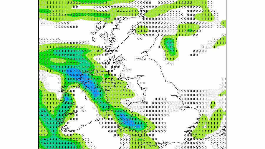
WEEKEND FORECAST ================ Issued: 1100 hrs, Thursday 11th February 2016 SATURDAY -------- A real messy one for Saturday. Low pressure is shown as crossing the south of the UK on Saturday, but the location of this is varying with each model run. Do keep checking as the forecast below is subject to change. For now we
World weather impacts of a El Nino flipping to La Nina – what does it mean?
After last years strong El Nino, the long predicted slip into La Nina conditions is now underway. And it will be a rapid descent too according to some models, with the mean of the ensemble forecast now bringing La Nina forward. The chart below shows a crash into La Nina sometime in
12Z GFS keeps a similar wintry theme on hills
Just released 12Z GFS is keeping the low crossing central Wales and England on Saturday (below). We're keeping with the idea of some wintry precipitation on high ground, but a carefully watch on Saturday evening as the low pulls away east. It's then that temperatures may start to tumble, encouraging the rain