

1 - Spells of rain: Following a lull in mid October when generally dry conditions dominated, rainfall has returned and most places will see some heavier rain at times this week. Central and southern areas in particular will be wetter as weather systems take a southerly track. 2 - Showery in
Musings
Temperature drop is coming

Rainfall levels forecast

Good day all, Well below you can see the rainfall anomaly from the mean levels for the next three weeks (https://charts.ecmwf.int/). It is obvious with the colors (reddish means lower than normal, greenish means higher than normal), that for the next three weeks the rainfall levels almost everywhere across the British
5 things for the weekend

🌧️ Widespread Showers: Periods of rain at times, occasionally heavy, especially in western areas.🌥️ Bright Intervals: Some breaks with sunshine between showers, mainly later in the day.💨 Breezy Conditions: Noticeably gusty at times, particularly near coasts and higher ground.🌈 Changeable Skies: Frequent shifts between cloud, rain, and clearer spells.🍂 Autumn
Inversion From Above
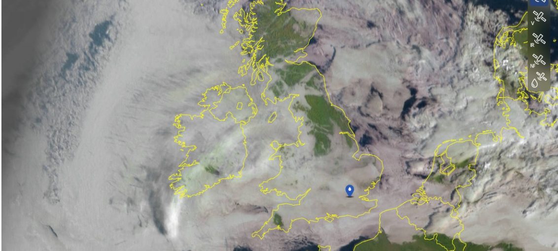
Not long now before the jets stream returns

There's a change ahead! The 500hPa charts below certainly show it well. See how early on we have that 'n' shaped ridge which has high pressure underneath it, but then notice the 'u' shape trough breaking through on Sunday, this bringing the more unsettled weather and low pressure. We then stay with a
Cold spells November & December?
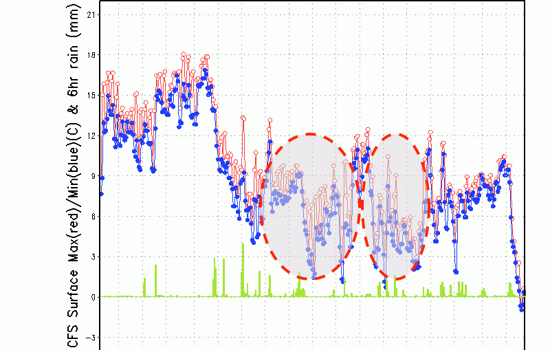
Interesting to see the latest 3-month forecast through to early January. The forecast temperatures and rainfall graph below is for London but it's good to use as a broad -brush look for the whole of the British Isles. Notice the two temperature falls, one around 18th November to 6th December and then
5 week ahead weather things to know

High pressure memories

Rainfall Levels

Good day all, Well below you can see the rainfall anomaly from the mean levels for the next three weeks (https://charts.ecmwf.int/). It is obvious with the colors (reddish means lower than normal, greenish means higher than normal), that for the next couple of weeks as the anticyclone will around our neighborhood,