

We have all had our fingers burnt in the past as pressure was forecast to rise, only to be disappointed when the expected improvement in conditions failed to materialise. However, we now have several days and good consistency between models that an improvement in conditions is ahead. Here's the forecast from several
Musings
Weekly Rainfall Anomaly

5 things for the weekend

🌧️ Unsettled Conditions: Showers remain frequent, some heavy with a risk of thunder and hail. 🌦️ Mixed Skies: A blend of cloudy periods, brief sunny spells, and passing showers across much of the area. 🌬️ Shifting Winds: Winds gradually turning northwesterly, helping to bring drier air from the west
Signs of a Warm Blast Next Week
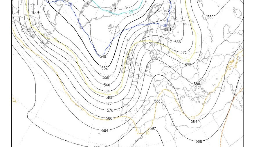
ECMWF 6-Week Outlook to mid-July

We are already thinking of mid-summer in the 6-week forecast, and with the current unsettled weather, all eyes are focused on when fine weather may return. Overall an improvement is likely mid-month and it could become warm. Then we get into more uncertain conditions with model signals being weak, but for now
Rising temperatures but still rain?

We have further signs from the 15-day GFS Ensemble of temperatures rising at the end of next week. The 15-day temperature and rainfall graph below is for central England and shows the warmer air. Notice there are still some green rainfall bars on there. They aren't very high and so probably indicating
Pressure building mid-month? More evidence!
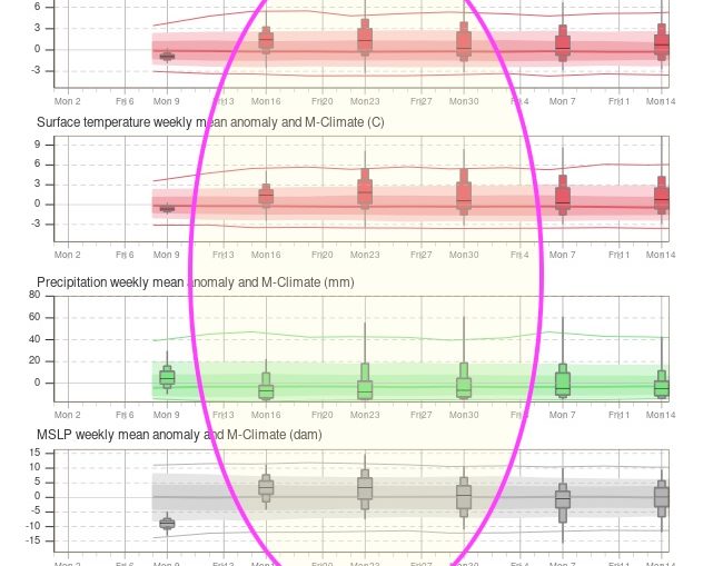
5 Weather Week Things To Know
Hints of an improvement in 10-days?

Uncertainty remains

Hello all Well there are some ongoing discussion regarding the comeback of the high pressure towards mid-June. Even though this is still the most possible scenario, as you can easily see from the Ensembles graph below (www.meteociel.fr) there is a big spread between the different model runs. But the bold red