

+++ THIS FORECAST IS FOR PRIVATE CLIENTS ONLY AND MAY NOT BE DISTRIBUTED OR COPIED IN ANY WAY WITHOUT PRIOR PERMISSION. +++ JULY 2025 - PRELIMINARY GUIDANCE =============================== Issued: Friday 20th June 2025 Contact: simon@weatherweb.net HEADLINES ========== + Mixed start + Pressure building and drier + Some thunderstorms in south FACTORS AFFECTING JULY 2025 PRELIMINARY GUIDANCE ================================================ + High pressure building, intially
Musings
5 things for the weekend

☀️ Hot in the South – Very warm across southern and southeastern areas, peaking at 32°C on Saturday. 🌦️ Showers from the West – Rain pushes in from the southwest Saturday afternoon, spreading northeastward. 🌧️ Unsettled Sunday in the West – Frequent, sometimes heavy, showers over Ireland and western
Rainfall Levels

Wednesday morning update on weekend rain

We seem to be settling on a story now for weekend rain and storms although amounts still uncertain. ECMWF 6-hour totals from 7pm Friday to 7pm Sunday. Thundery ran Southern Ireland Saturday morning, spreading north through Wales, the Midlands, northern England, Scotland and Ireland in the afternoon and then overnight into Sunday
July Analogues, another look
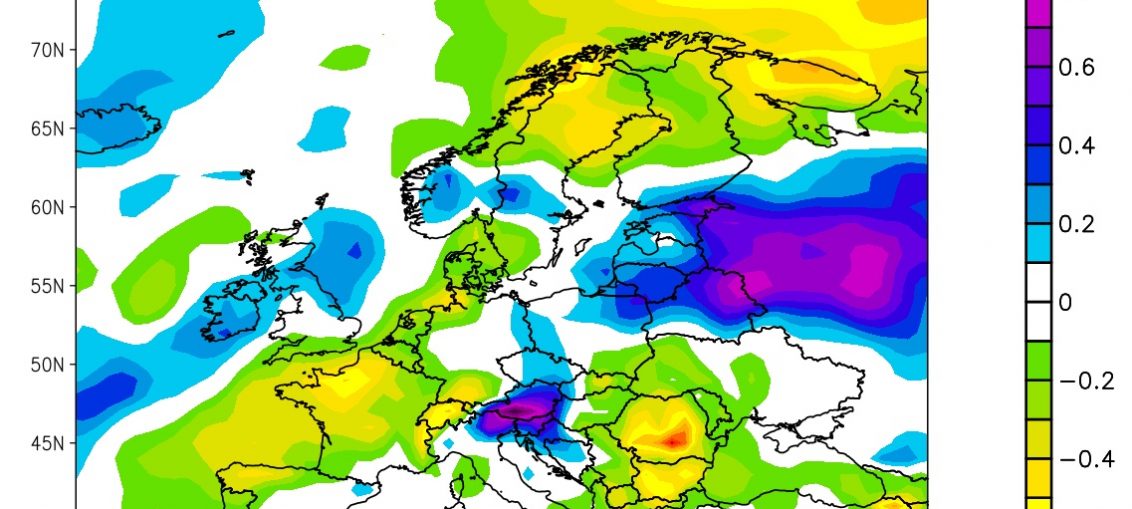
Th 500hPa analogue for July is below. This looks back to the mid-1800's and compares weather patterns that are similar to this year, and we then rank the top nine similarities. This doesn't make especially good viewing with the purple colours showing through Scotland and across Scandinavia. The blue colours extend through
5 things for weather through the week

☀️ Plenty of Sunshine – High pressure will bring widespread dry and bright conditions across much of the country. 🌦️ Scattered Showers – Intermittent showers expected, mostly in the northwest and western regions. 🌡️ Warm in the South – Temperatures rising into the mid-20s°C in southern and southeastern areas.
Rainfall Amounts

5 things for the weekend

🌦️ Unsettled start to the weekend, with heavy, thundery showers and risk of hail on Saturday morning, especially in England and Ireland. 🌧️ Showers retreat northwards through Saturday, becoming confined to Scotland and Northern Ireland by evening, with drier spells elsewhere. 🌤️ Sunday brings more brightness, especially over central and southern England,
ECMWF Outlook to late July
There are some signs of better weather ahead. The ECMWF picks up on this and here are the latest thoughts... 16th June to 22nd June High pressure, probably centred over Ireland. Fair for most, good spells of sunshine. Warm overall. Risk of some rain in northwest Scotland. Best sun in south. 23rd June to 29th June High squeezed to
